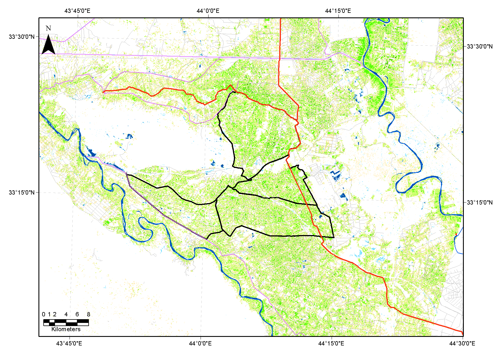
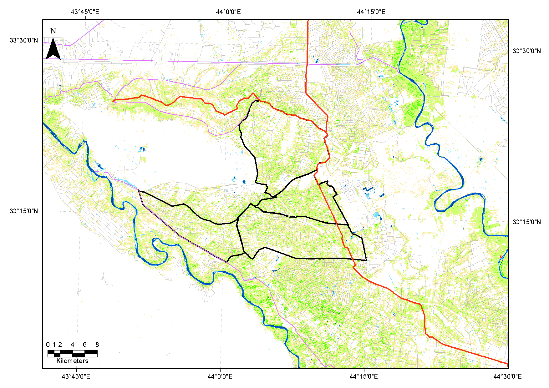
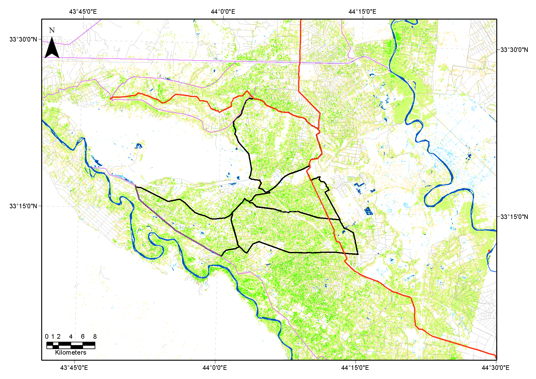
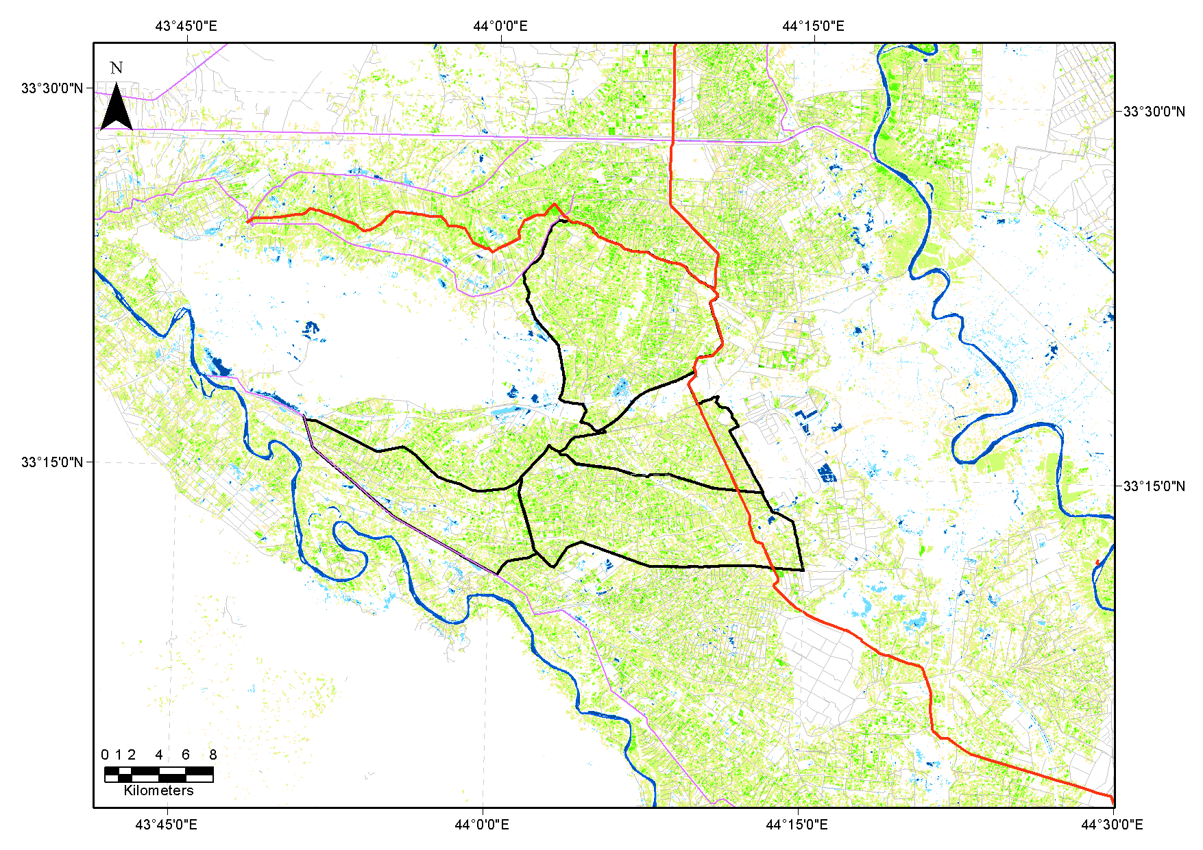
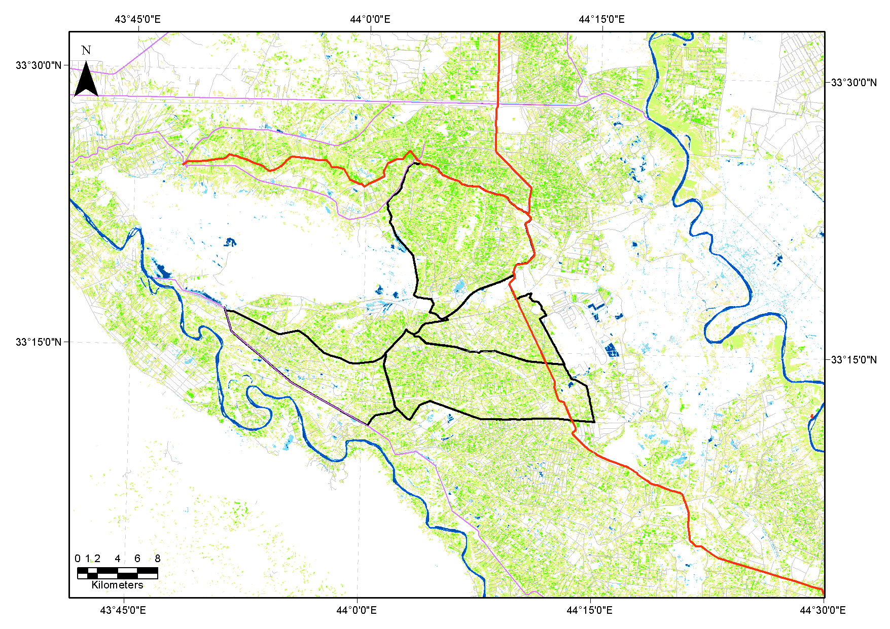
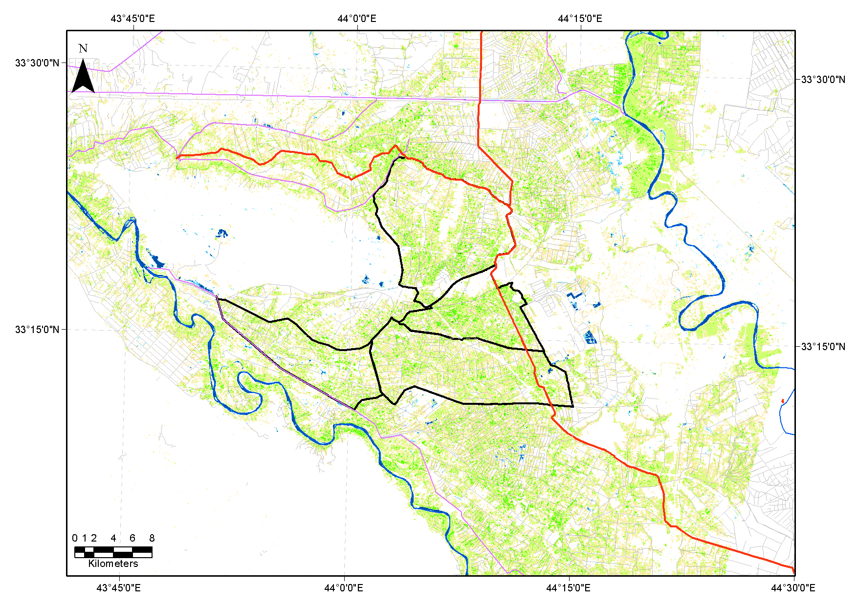
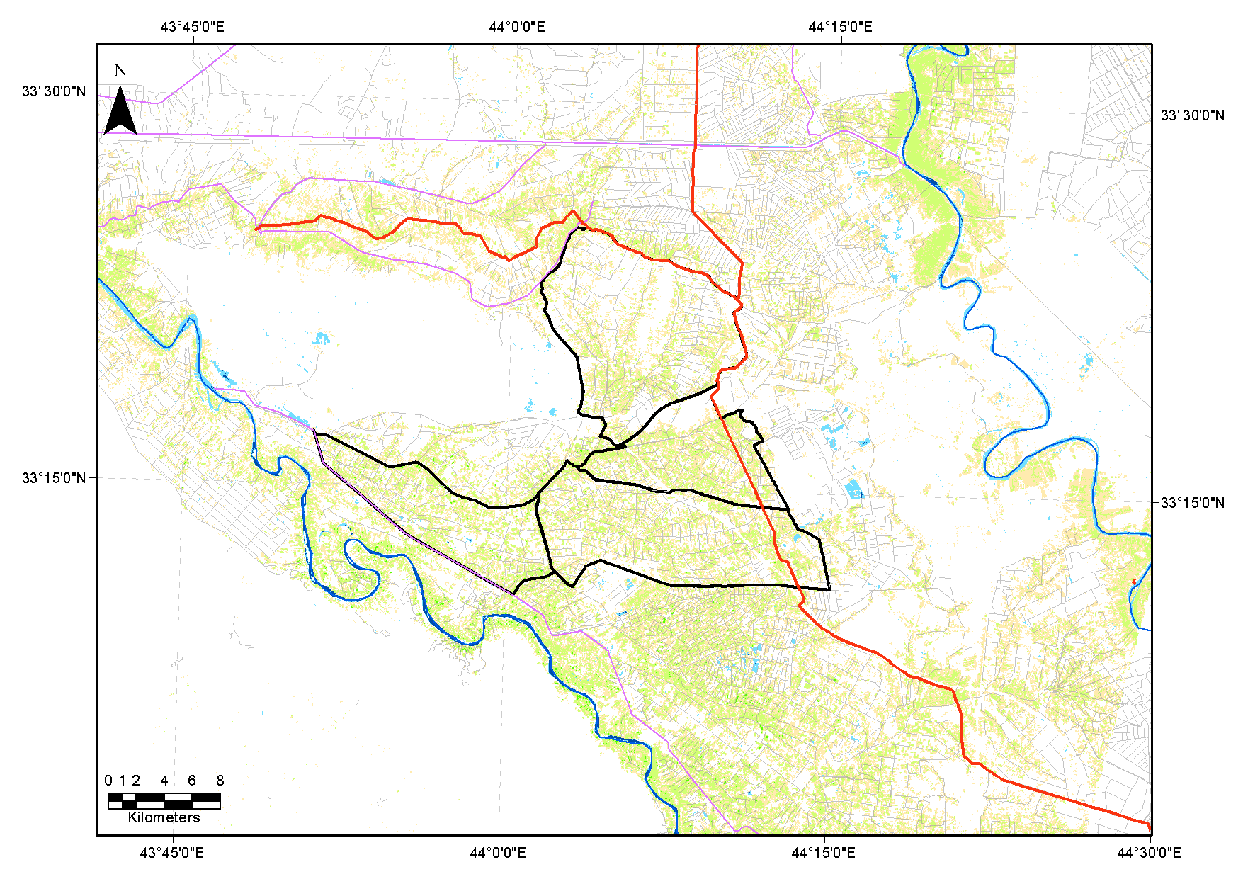
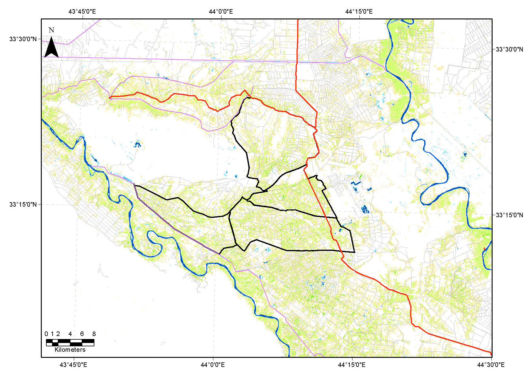
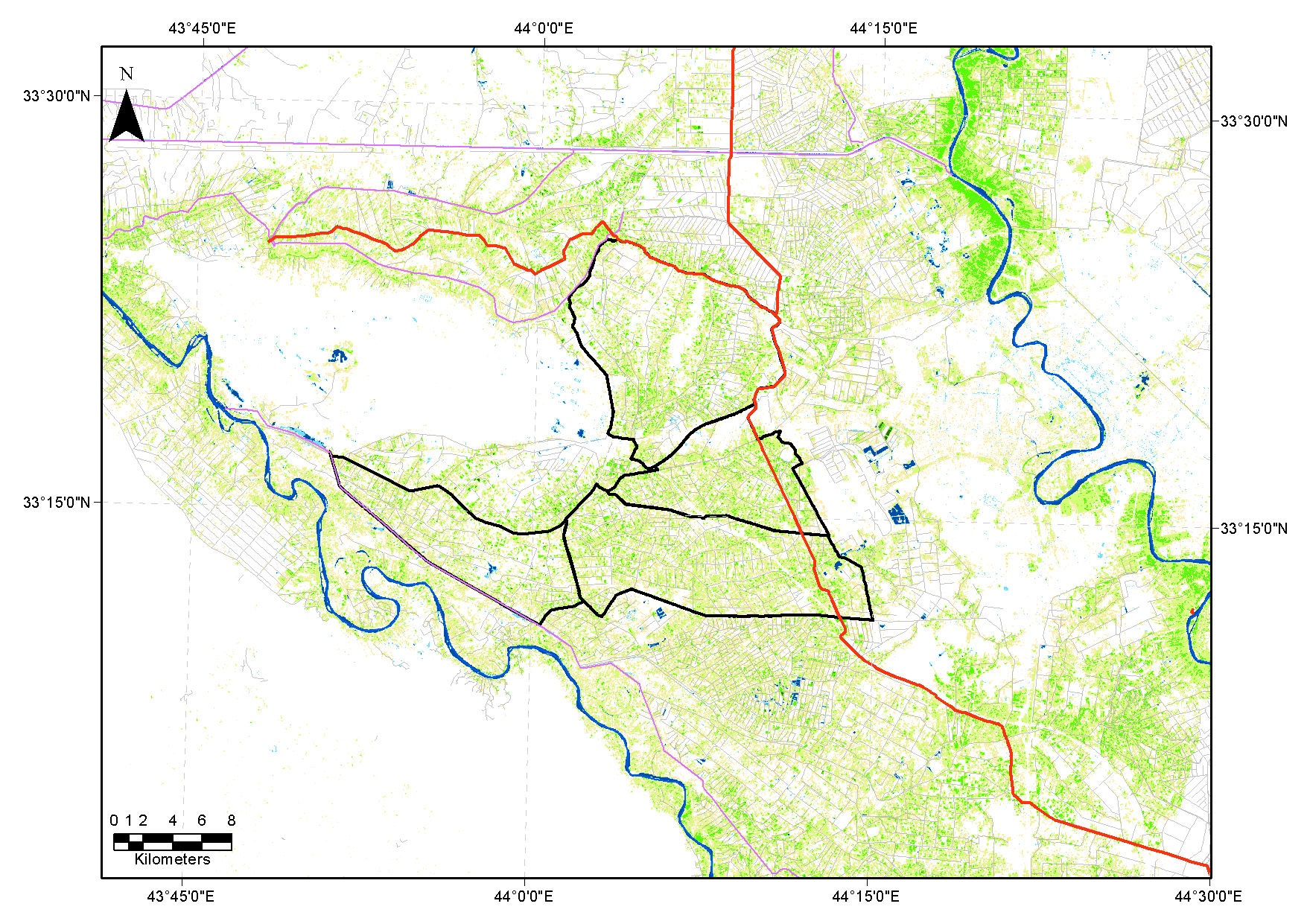
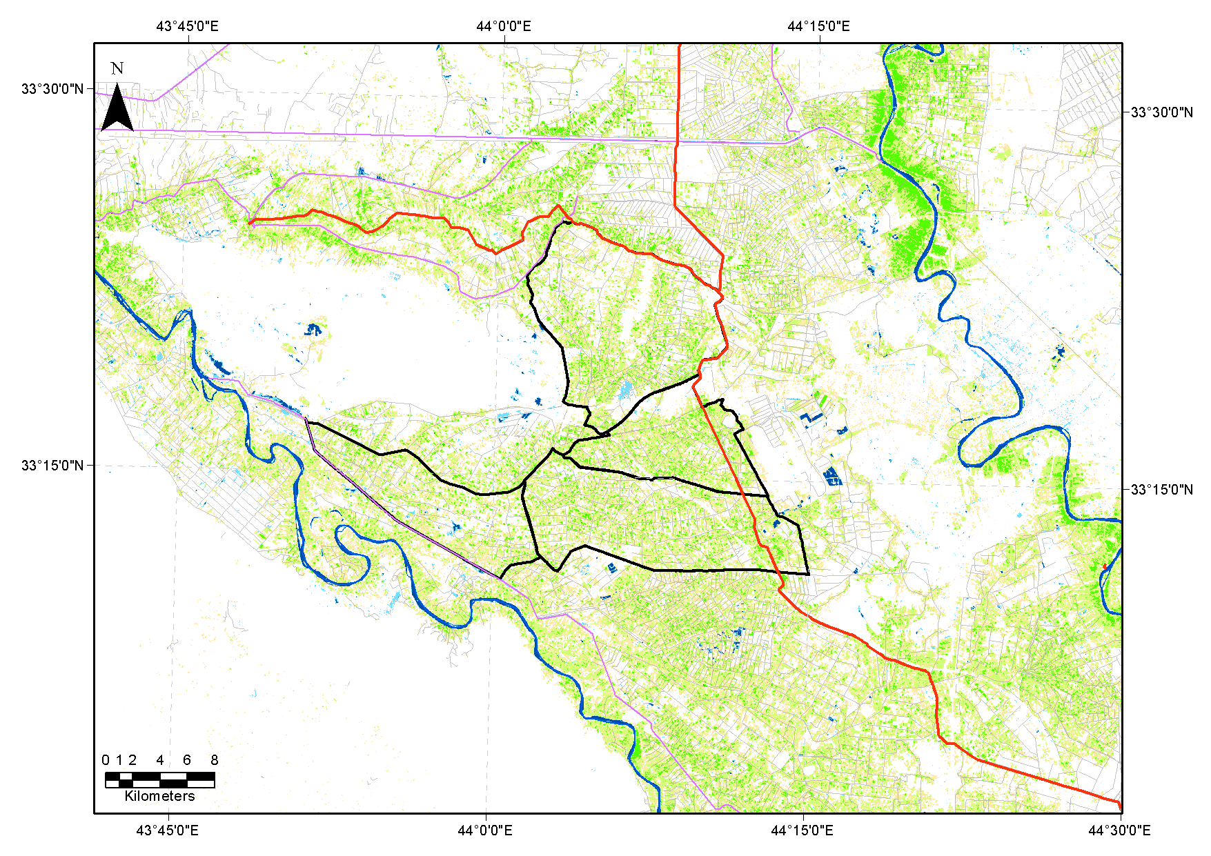
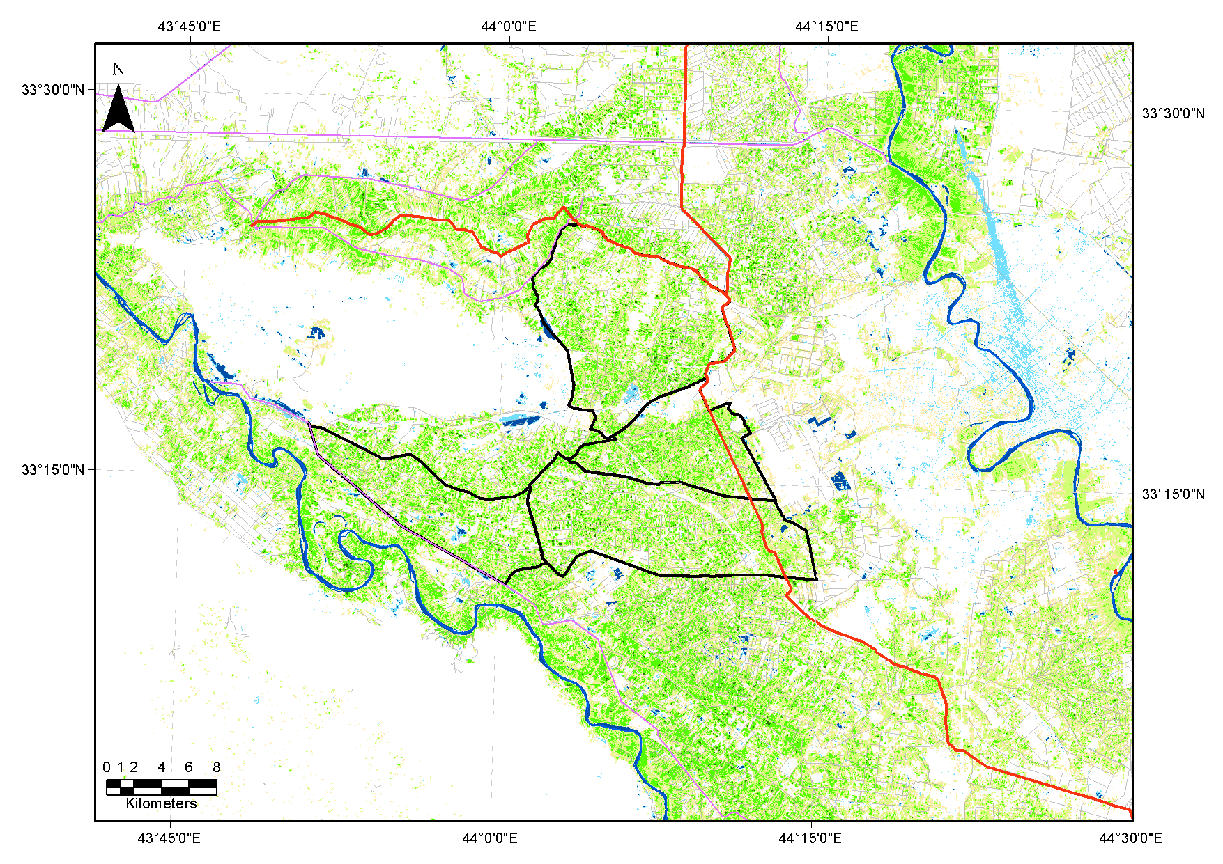
Remote sensing analysis using Landsat TM and ETM data show the agricultural seasons in the Abu Ghreib irrigation project.
Colors indicate the value of NDVI calculated based on corrected reflection data. Yellow/brown are values around 0.3-0.4,
while bright green indicate values around 0.6-0.7. July and August are shown to have low NDVI values, related to low
vegetation cover (end of growing season). November and April appear to have high NDVI values in the analyzed time series.
Note that statements related to "land lost to salinity" based on remote sensing analysis need to be scrutinized carefully.
Water availability has as much influence on the area under cultivation than salinity build-up has. In addition, a shortage
of water in the flat areas of the Mesopotamian plain would likely result in accumulated salts in the root zone due to
capillary rise from shallow groundwater.